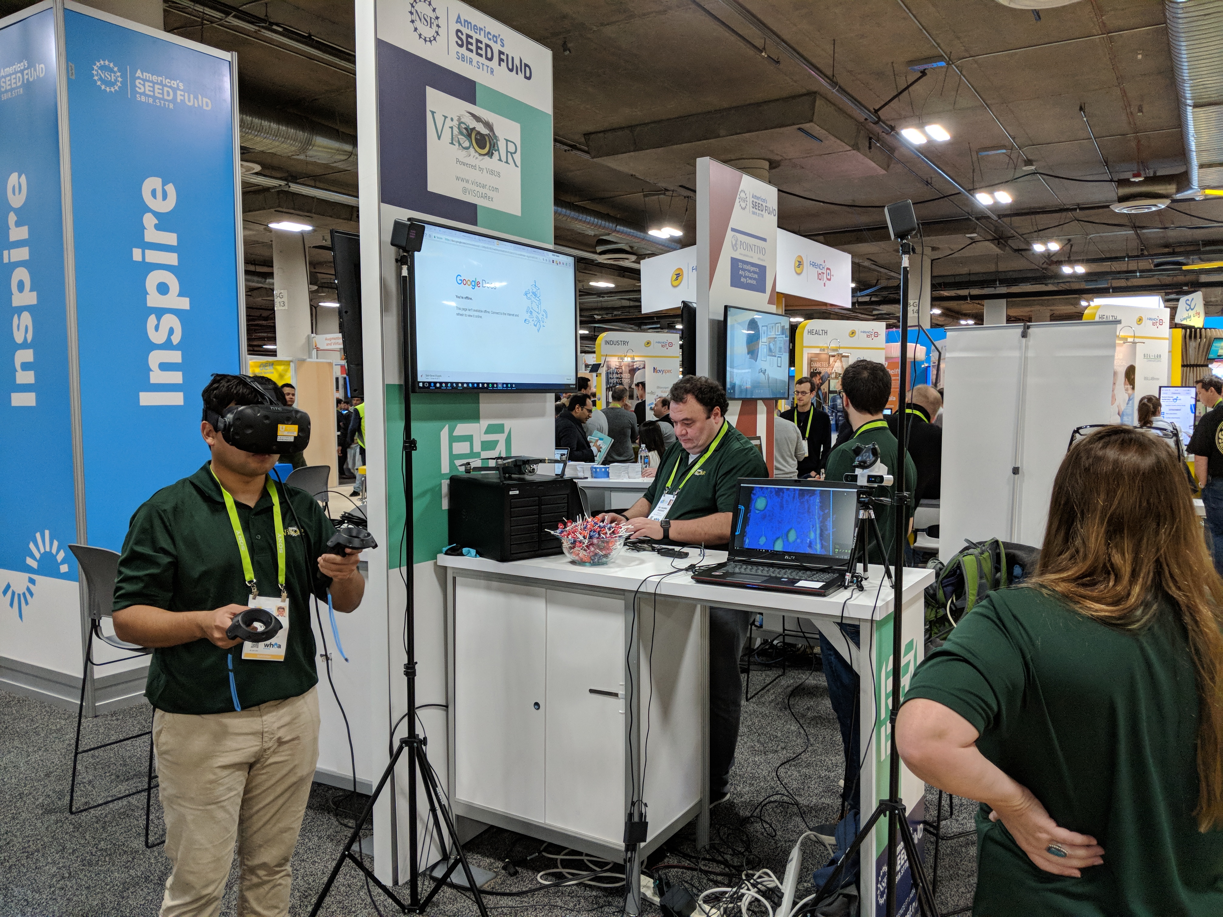
 ViSUS LLC is one of 16 start-ups selected to exhibit in the NSF SBIR (“America’s Seed Fund”) pavilion at the 2018 CES Eureka Park.
"With access to more than 3,500 financial professionals, 7,000 members of the media, key investors and suppliers, Eureka Park provides startups with a unique opportunity to showcase their ingenuity" [CES].
ViSUS LLC has been awarded a National Science Foundation (NSF) Small Business Innovation Research (SBIR) Phase II grant for $746,107 in collaboration with the Scientific Computing and Imaging Institute of the University of Utah to commercialize innovative technology by conducting research and development (R&D) work on the Immediate Delivery of Massive Aerial Imagery to Farmers and Crop Consultants. ViSOAR Ag Explorer enables farmers and crop consultants to decrease inputs and increase yields using aerial imagery, in minutes not days. Through America's Seed fund provided by the National Science Foundation, small businesses can receive up to $1.5 million in funding. Companies must first have received a Phase I award (up to $225,000) to become eligible to apply for a Phase II grant (up to $750,000) to further develop and commercialize the technology. Small businesses with Phase II grants are eligible to receive up to $500,000 in additional matching funds with qualifying third-party investment or sales.
ViSOAR solutions by ViSUS provides fast reading and writing of 2D, 3D, or multidimensional grid data for platform agnostic collaborative analytics and visualization. Our latest product, ViSOAR Ag Explorer™, demonstrates the technical and commercial feasibility of real-time stitching of massive aerial image mosaics on commodity hardware. Drone captured images are stitched to form a map, allowing a crop consultant or farmer to immediately analyze images right after acquisition. ViSOAR Ag Explorer™ will remove the software bottleneck (time and labor) in processing large aerial surveys, enabling a cost-effective process to deliver actionable information to farmers. In turn, farmers and farm consultants can optimize the use of fertilizers and more finely control the amount of pesticides and herbicides necessary to increase crop yield. Furthermore, farmers mitigate costs and losses by being able to spot problem areas, minimize the spread of plant diseases, and identify issues such as standing water, irrigation malfunctions, and persistent automated machinery errors in planting or cultivation. The technology proposed by ViSUS is part of a broad initiative in agriculture addressing the need for a 70% increase food production by 2050 in response to the projected growth of the world's population.
ViSOAR Ag Explorer provides a solution for stitching of full resolution aerial imagery in the field without requiring an internet connection, making it an indispensable part of the software stack underlying every agricultural UAS system sold. Agisoft, Photoscan, and Pix4D each take approximately 4 hours to process 100 images on a high-end workstation, or up to 8 hours for imagery per flight; far too time consuming for large-scale deployment. Our goal is provide in field image stitching at a coarse resolution that progressively solves 600 images in 10 minutes providing a full resolution view of the data, enabling instant analytics.